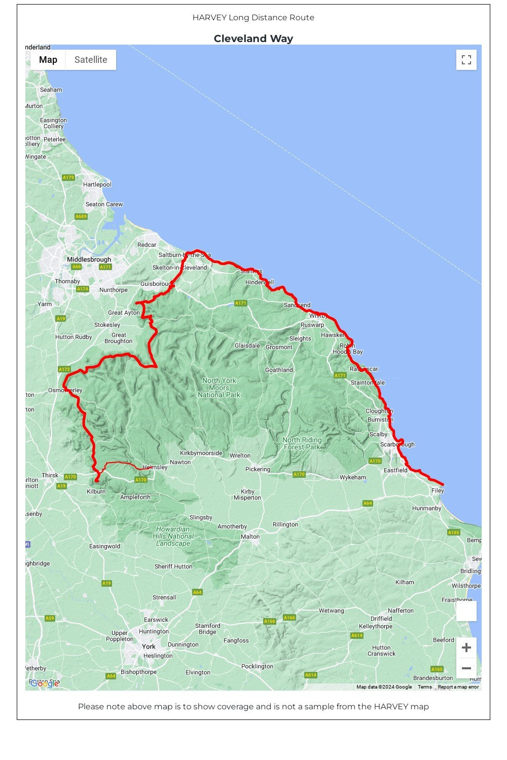
The Cleveland Way National Trail is 174km (109 miles) from Helmsley across the North York Moors National Park to Saltburn and then along the coast via Scarborough, ending at Filey.
• Tough, light, durable and 100% waterproof • Includes Rights of Way • Genuine original HARVEY mapping • Route clearly marked • The map is conveniently laid out in panels so you only carry the mapping you need