1
/
of
2
My Store
M61BC2 Cambrian Way North Trail Map
M61BC2 Cambrian Way North Trail Map
Regular price
$12.25 USD
Regular price
$17.00 USD
Sale price
$12.25 USD
Shipping calculated at checkout.
Quantity
Couldn't load pickup availability
The first dedicated maps for "The Mountain Connoisseur's Walk"
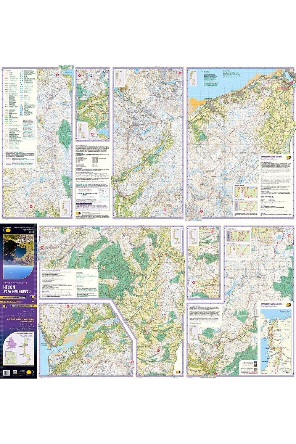
The Cambrian Way is a challenging mountain trail that runs from Cardiff Castle in South Wales to Conwy Castle in North Wales.
This map is Cambrian Way North - it covers the route from Devil's Bridge to Conwy.
The entire route is 479km (298 miles) long and has nearly 24,000 metres of elevation - the route goes over many of Wales' major mountains and takes in some of the country's finest scenery, traversing both Bannau Brycheiniog (Brecon Beacons) and Eryri (Snowdonia) National Parks.
The route takes approximately 3 weeks to walk and is covered on 2 separate waterproof maps - Cambrian Way South (Cardiff to Devil's Bridge) and Cambrian Way North (Devil's bridge to Conwy).
As this is often a remote route, a map and compass are essential for the long, un-waymarked stretches of exposed and unspoiled wilderness. If you like peace and quiet then this is the walk for you!
• Tough, light, durable and 100% waterproof
• Includes Rights of Way
• Genuine original HARVEY mapping
• Route clearly marked
• Each map weighs just 40g
Technical Specification
• Scale: 1:40,000
• Ratio: 2.5cm = 1km
• Flat size: 928 x 486mm
• Folded size: 116 x 243mm
• Weight: 42gms
• Double sided
• Format: strip map
Share